

Denmark Maps
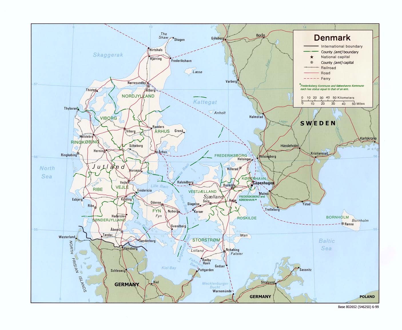
- Denmark (Political) 1999 (195K) and pdf format (198K)
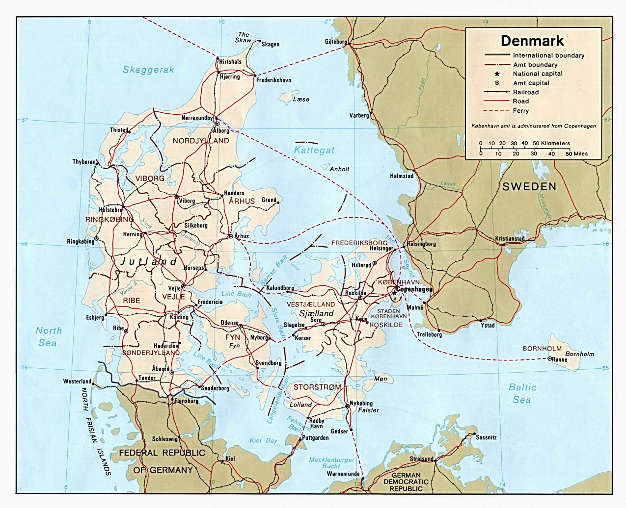
- Denmark (Political) 1981 (253K)and pdf format (257K)
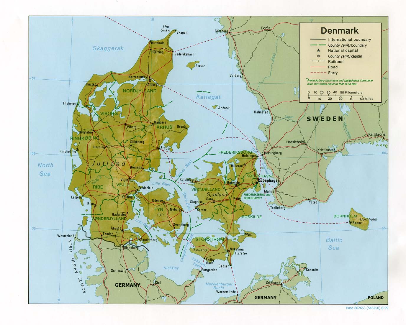
- Denmark (Shaded Relief) 1999 (191K) and pdf format (204K)
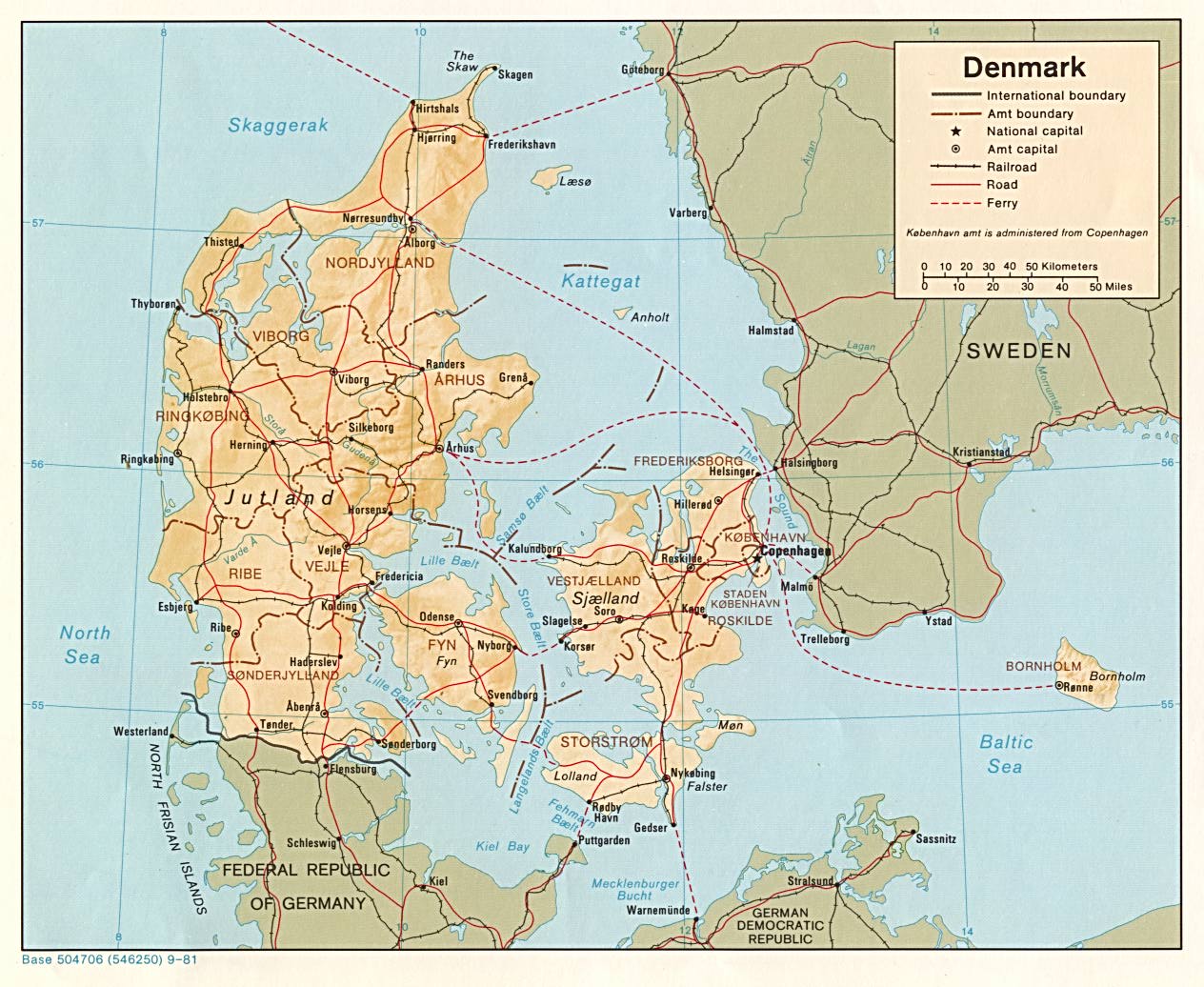
- Denmark (Shaded Relief) 1981 (235K)and pdf format (238K)
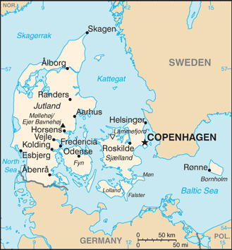
- Denmark (Small Map) 2014 (26.3K)
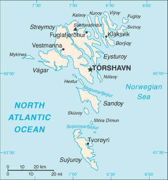
- Faroe Islands (Small Map) 2014 (10.9K)
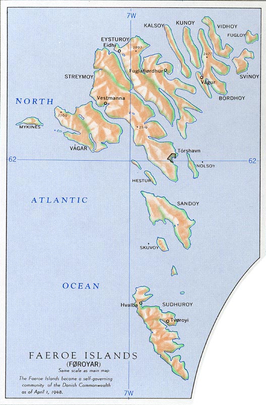
- Faroe Islands from Nuclear Weapons and NATO: Analytical Survey of Literature, United States. Department of the Army, 1970 (167K)
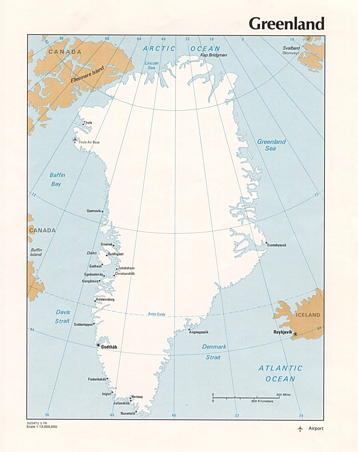
- Greenland (Political) 1976 (182K)
- Greenland (Small Map) 2014 (35.6K)
City Maps
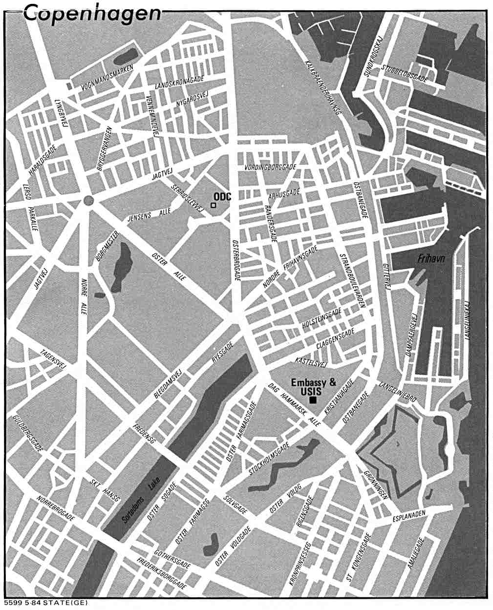
- Copenhagen U.S. Dept. of State 1984 (100K)
Regional Maps
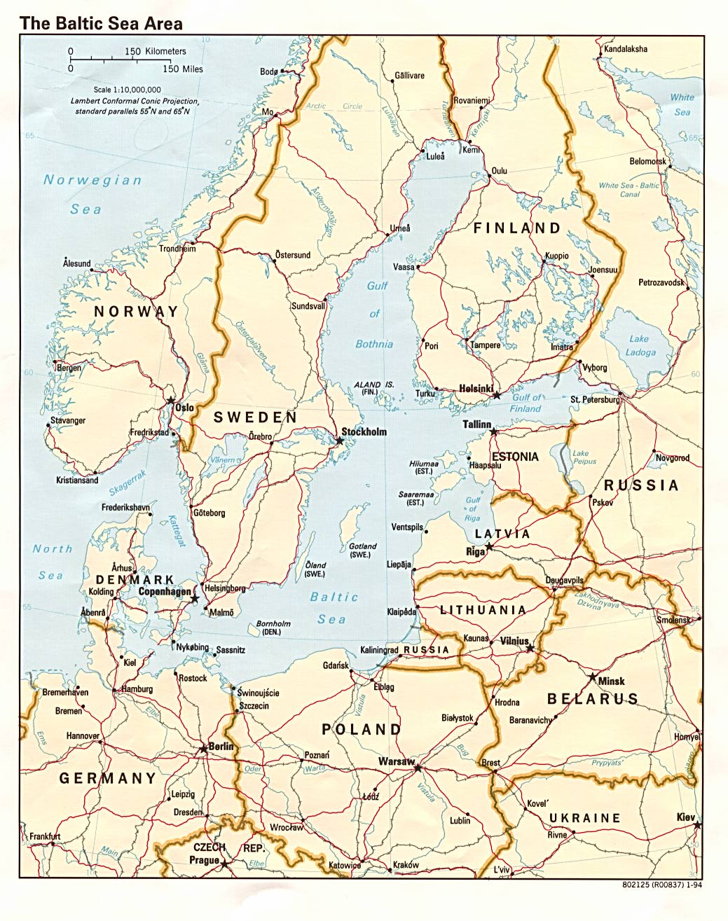
- Baltic Sea Area (Political) 1994 (276K)
Thematic Maps
- Denmark – Industry from Map No. 501760 1974 (128K)
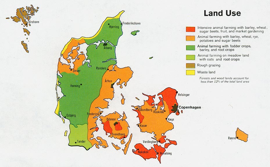
- Denmark – Land Use from Map No. 501760 1974 (131K)
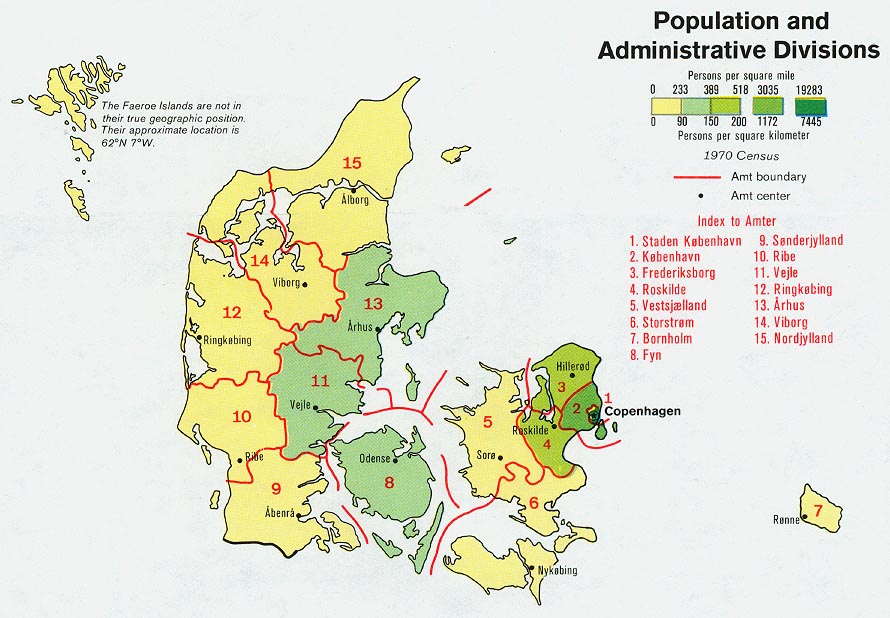
- Denmark – Population and Administrative Divisions from Map No. 501760 1974 (136K)